Main menu
Route Planning Tips
Route planning has a HUGE impact on safety!
There are many considerations to take into account when choosing a bike route, such as traffic, bike paths, speed, and even scenery! The newest cycling evidence shows that the routes we take have a strong impact on bike safety.
Region-wide, 46% of the cycling network in Metro Vancouver is assessed as comfortable for most people, and about 65% of residents live within 400 metres of such a bikeway. The City of Vancouver leads the region, with 76% of its network classified as comfortable for most, and 90% of residents within 400 metres of such a route.
Which road would you rather ride on?

The good news is that the routes that people prefer to ride on often align with the safest routes, with a couple of key exceptions.
Three least safe route types:
- Major street with parked cars
- Multi-use pathway
- Major street, with a bike lane and parked cars (shown above
Three safest route types:
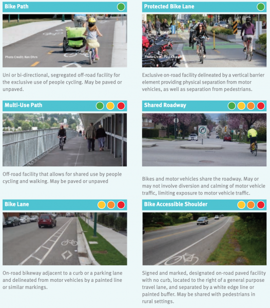
- Cycle Track (separated bike lane)
- Residential street, bike route (shown above)
- Residential street
★ People often perceive multi-use paths as one of the safest routes to take, when in fact it has one of the highest rates of collisions! While the collisions are not severe because there are no cars involved, it’s important to teach kids courteous riding, while sharing space with other riders, dog-walkers, skateboarders, and strollers.
★ Residential streets are always safer than major streets whether or not it is a bike route. If you are going to bike on a major street, those without parked cars are by far safer than those with parked cars.
To learn more about the Metro Vancouver cycling infrastructure, read the 'Benchmarking the State of Cycling in Metro Vancouver' report produced in collaboration with TransLink.
Route planning resources:
- Google Maps
- BikeMaps.org
- BikeRoutePlanner.com
- Municipal bike maps print out (available at HUB and your local City Hall)
For more information about school route planning, please contact schools@bikehub.ca
